Integrating advanced technologies into fields has transformed the way we cultivate and manage crops. As agricultural landscapes evolve, the role of unmanned aerial vehicles and smart decision-making platforms becomes increasingly critical. This article explores how modern innovations empower growers to optimize productivity, enhance resource management, and promote environmental stewardship.
Smart Drone Technology in Modern Agriculture
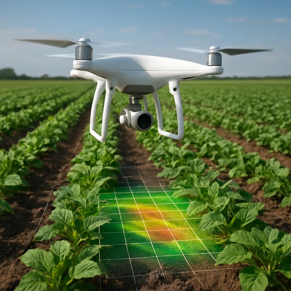
High-performance drones equipped with multispectral and thermal cameras are redefining inspection routines. Instead of walking miles of orchards or fields, farmers can deploy these aerial systems to collect detailed data within minutes. Thanks to precise GPS navigation and automated flight paths, each mission covers vast areas with precision farming accuracy, ensuring consistent and repeatable scans.
Key Components of Agricultural Drones
- Sensors: Multispectral, RGB, and thermal modules capture diverse wavelengths, revealing hidden stress patterns.
- Flight Controllers: Advanced autopilot units manage altitude, speed, and mission planning without manual intervention.
- Communication Links: High-bandwidth radio or cellular connections transmit live telemetry to ground stations.
- Battery Systems: Long-lasting power packs enable extended flight times, reducing downtime between sorties.
Benefits for Crop Surveillance
By leveraging imagery gathered at regular intervals, growers can detect early signs of pests, nutrient deficiencies, and moisture variations. Automated alerts generated from image comparisons highlight anomalies, allowing for immediate follow-up actions such as targeted spraying or irrigation adjustments. This approach significantly reduces input costs while improving overall plant health.
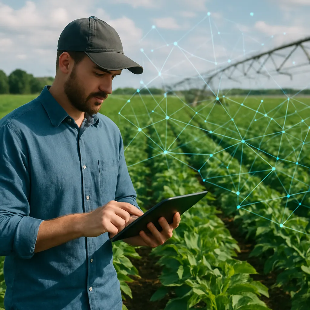
AI-driven Data Analysis for Crop Health
Raw drone footage becomes truly invaluable when paired with robust AI platforms. Machine learning algorithms process thousands of data points from aerial scans, identifying patterns that are invisible to the naked eye. From classification of weed species to pinpointing zones of irrigation underperformance, AI engines transform visual inputs into actionable recommendations.
Vegetation Indices and Their Applications
- Normalized Difference Vegetation Index (NDVI): Measures chlorophyll density, indicating photosynthetic activity and overall vigor.
- Normalized Difference Water Index (NDWI): Highlights water stress and irrigation needs by comparing near-infrared and shortwave infrared bands.
- Green Normalized Difference Vegetation Index (GNDVI): Focuses on specific green wavelengths to assess nutrient status and leaf area index.
When processed in real-time, these indices enable dynamic field mapping, where each square meter of farmland is assigned a risk score. Farmers can then prioritize interventions based on severity, minimizing resource waste and maximizing yield potential.
Automated Issue Detection and Alerting
Combining historical records with current flight data, AI models can predict outbreak trends for diseases or pest infestations. When threshold levels are exceeded, automated notifications are sent via mobile apps or email. This proactive stance allows for prevention strategies rather than reactive treatments, fostering healthier crops and reducing reliance on heavy chemical usage.
Sustainable Practices and Practical Tips
Embracing technology is only one piece of the sustainability puzzle. Integrating eco-friendly practices alongside digital tools ensures long-term soil fertility and ecosystem balance. Below are key recommendations:
- Implement Crop Rotation: Alternate plant families to disrupt pest lifecycles and restore nutrient balance.
- Use Cover Crops: Plant legumes or grasses during off-seasons to prevent erosion and enhance organic matter.
- Optimize Irrigation: Combine drone-based moisture maps with drip or pivot systems to conserve water.
- Adopt Integrated Pest Management (IPM): Rely on a mix of biological controls, monitoring traps, and targeted applications.
- Maintain Soil Tests: Regular lab analyses inform precise fertilizer and amendment needs, reducing over-application.
Farmers who follow these guidelines in tandem with remote sensing gain a competitive edge. For instance, pairing ground-based sensors with aerial surveys can validate water and nutrient distribution, ensuring that every drop and gram of input leads to measurable improvements.
Future Outlook: Innovations on the Horizon
Ongoing research is pushing the boundaries of autonomous agriculture. Swarm technology, where fleets of mini drones communicate and coordinate, promises to increase coverage speed and redundancy. At the same time, edge computing enables on-board analysis, reducing data transfer requirements and delivering instant insights at the field level.
Advancements in sensor materials will allow new biomarkers—such as volatile organic compounds—to be detected from high altitude, offering early warnings of physiological stress. Meanwhile, blockchain-based traceability can securely log every flight, analysis, and intervention, building consumer trust in farm-to-fork supply chains.
As these innovations mature, the combination of artificial intelligence, unmanned flight, and sustainable techniques will shape a future where agricultural productivity and environmental conservation go hand in hand. Farmers equipped with these tools will be better positioned to meet global food demands while protecting natural resources for generations to come.
