Precision farming transforms the way modern farmers approach crop production by integrating advanced satellite systems and state-of-the-art agricultural machinery. By leveraging Global Positioning System technology, growers can make real-time decisions backed by detailed field information. This article delves into practical methods for using GPS technology to optimize planting, irrigation, and harvesting, ensuring resource efficiency and maximizing crop yield.
Understanding GPS Technology in Agriculture
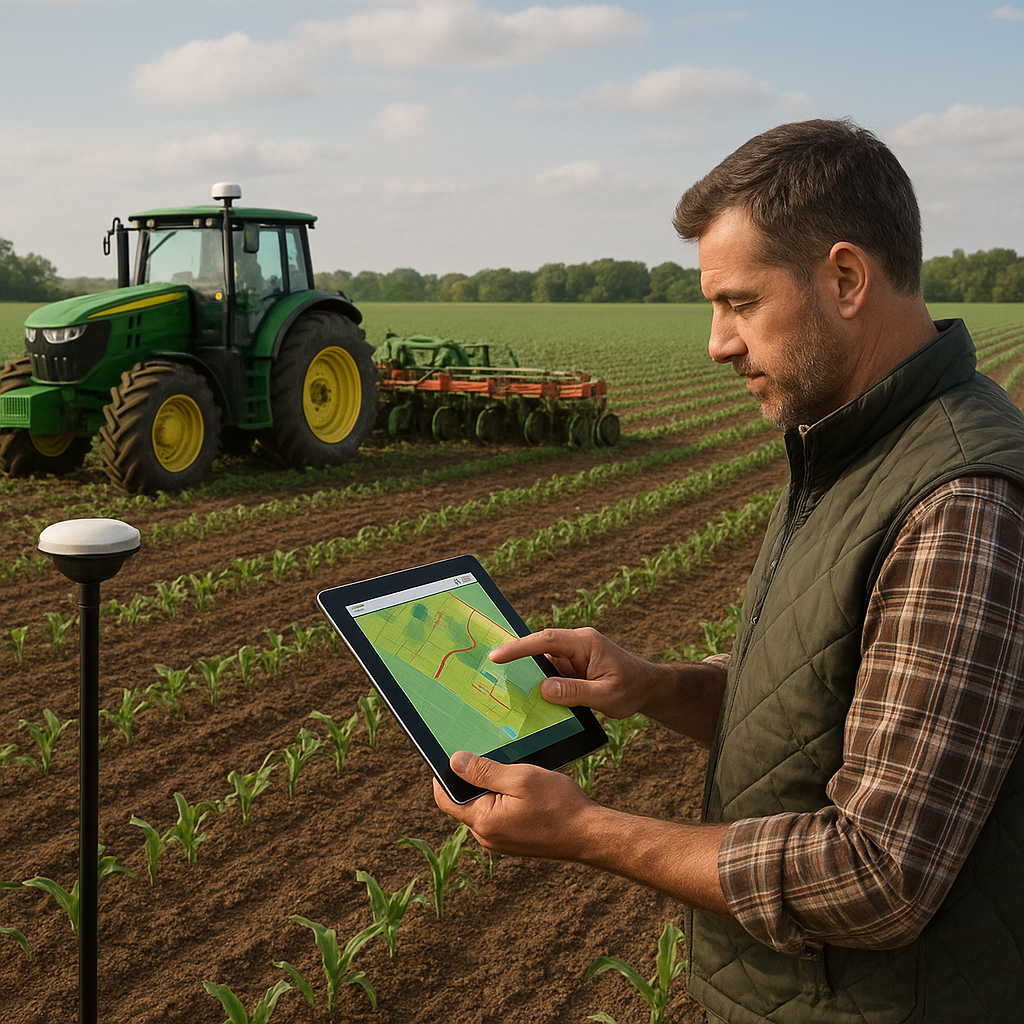
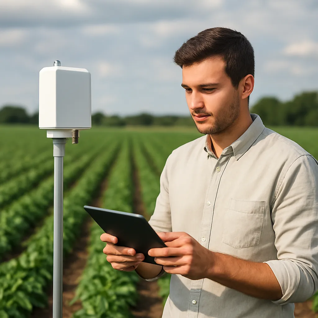
GPS, originally developed for navigation, has become a cornerstone of precision agriculture. At its core, the system involves a network of satellites communicating with ground-based receivers to determine exact coordinates. Farmers can mount these receivers on tractors, combine harvesters, or handheld devices to track machinery location, monitor field boundaries, and record soil conditions.
Key Components of an Agricultural GPS System
- Satellite Constellation: Provides continuous signals globally.
- Ground-Based Receivers: Installed on equipment for real-time positioning.
- Data Loggers: Store location and sensor measurements.
- Software Platforms: Analyze and visualize spatial information.
Integration with other sensor technologies—such as yield monitors, moisture probes, and variable-rate spreaders—enhances the overall capability of a GPS-based approach. By translating spatial data into actionable insights, farmers can adopt targeted interventions rather than blanket treatments across the entire field.
Implementing GPS for Field Mapping and Soil Analysis
Accurate field mapping is the first step toward effective precision farming. Traditional methods relying on manual surveying are time-consuming and prone to error. With a GPS-enabled system, producers can quickly generate georeferenced maps showing soil types, fertility zones, and drainage patterns.
Steps to Create Detailed Field Maps
- Divide fields into manageable zones based on topography and soil texture.
- Collect soil samples at regular GPS-recorded points for laboratory analysis.
- Upload lab results into geographic information system (GIS) software.
- Overlay historic yield data to pinpoint high- and low-performing areas.
Combining soil nutrient levels with GPS location tags provides a data-rich foundation for variable-rate fertilization. Rather than applying uniform fertilizer rates, variable-rate spreaders adjust input quantities on the go, reducing waste and environmental impact. Additionally, soil moisture sensors linked to GPS coordinates help farmers optimize irrigation schedules by identifying dry patches that require extra attention.
Enhancing Crop Management with GPS Precision
Precision planting is a direct application of GPS technology that aligns seeding equipment precisely with field maps. This approach ensures seeds are placed at optimal spacing and depth, boosting germination rates and plant uniformity.
Benefits of GPS-Guided Planting
- Improved efficiency through automated row guidance.
- Reduced overlap and gaps, saving seeds and fuel.
- Uniform emergence increases overall crop health.
- Enhanced potential for mechanical weed control between rows.
GPS guidance also extends to pesticide and herbicide application. Modern sprayers equipped with variable-rate control use GPS maps to precisely target weed-infested zones, minimizing chemical use and lowering production costs. By integrating yield monitors, farmers can compare predicted outputs to actual results, refining application maps for subsequent seasons.
Leveraging GPS Data for Smart Resource Management
Resource conservation is a fundamental goal of precision agriculture. GPS-enabled equipment helps operators apply water, fertilizers, and agrochemicals only where needed, reducing both input expenses and ecological footprint.
Smart Irrigation and Fertilization
- Use GPS-based soil moisture mapping to set variable-depth irrigation.
- Implement automation in drip and pivot systems guided by precise field coordinates.
- Program fertilizer applicators to adjust rates according to nutrient maps.
- Monitor real-time weather data to avoid overwatering during rainfall.
By analyzing historic and current GPS-tagged records, farm managers can forecast resource needs, anticipate breakdowns, and schedule maintenance. This predictive approach enhances equipment longevity and avoids costly downtime during critical periods such as planting and harvest.
Future Trends and Best Practices in Precision Farming
Emerging technologies are amplifying the power of GPS-based solutions in agriculture. Drones equipped with multispectral cameras can capture high-resolution crop imagery, which—when combined with GPS coordinates—allows for swift detection of pest outbreaks, nutrient deficiencies, or disease hotspots.
- Integration of GPS with Internet of Things (IoT) devices for continuous field monitoring.
- Machine learning algorithms analyzing analytics and spatial data to predict yield outcomes.
- Adoption of autonomous vehicles guided by satellite signals for seeding, spraying, and harvesting.
- Emphasis on sustainability through reduced carbon footprint and optimized input usage.
To maximize the benefits of GPS technology, farmers should adhere to these best practices:
- Regularly calibrate receivers and sensors to maintain positional accuracy.
- Update GIS software and firmware on field equipment.
- Invest in training programs to build technical proficiency among staff.
- Collaborate with agronomists and technology providers for continuous improvement.
Adopting these strategies ensures that precision farming remains a dynamic, evolving discipline—one that continues to enhance profitability, environmental stewardship, and the resilience of global food systems.